
Edinburg ZIP Code Coverage
Four postal codes appear in official Edinburg-area addresses found during research: 78539, 78540, 78541, and 78542. That fact confirms use, not exact delivery boundaries. The available sources did not provide official USPS polygons, ZIP-specific neighborhood names, a split date, or per-ZIP registration totals. Treat each entry below as a verified address-use signal and confirm a particular address with USPS before attaching it to a parcel or a person.
| ZIP | Areas Covered | Post Office | Notes |
|---|---|---|---|
| 78539 | Edinburg addresses used by City Hall, Planning, the courthouse, and many central-city offices | Edinburg Post Office, 410 S Jackson Rd., 78539-9998 | Standard delivery use is documented; exact polygon and city-limit overlap remain unverified |
| 78540 | Edinburg county mailing and P.O. Box addresses | Edinburg postal service/P.O. Box designation; station name not separately confirmed | Use as a mailing ZIP unless USPS validates a street-delivery address |
| 78541 | Edinburg address use, including the county Elections warehouse and training annex | Servicing station not located | Exact postal boundary needs USPS confirmation |
| 78542 | Edinburg address use, including the Hidalgo Sheriff address | Servicing station not located | Exact postal boundary and city-limit overlap were not captured |
The 78539 post office's listed retail hours are Monday through Friday, 8:30 a.m. to 5 p.m., and Saturday, 9 a.m. to noon. Its phone is 956-383-3866. Those details identify a local postal contact, not the boundary of an Edinburg postal area.
Edinburg Postal Labels Explained
A ZIP code routes mail. It is not the same field as a parcel's situs, a tax-bill mailing address, or the legal description in a deed. The situs is the physical parcel location. The legal description identifies land through a subdivision, lot, block, acreage, abstract, or metes-and-bounds wording. A mailing address sends correspondence to an owner. Postal labels can cross municipal or county lines, so none of those three property fields should be replaced by a ZIP alone.
- ZIP and ZIP+4
- A five-digit ZIP directs mail to a broad postal area. ZIP+4 adds four digits that refine delivery routing for a narrower segment.
- P.O. Box ZIP
- A postal code used for box or mailing service. It does not establish the physical location of a parcel.
- Unique ZIP
- A ZIP assigned to one large organization or delivery point. No Edinburg unique ZIP was verified in the research.
- Carrier route
- A postal delivery sequence used by a carrier. It is not a municipal boundary or a public record of households.
Note: No verified source established that any one of the four local ZIPs belongs exclusively to a named Edinburg neighborhood.
Verifying Edinburg Mail Routing
Use the USPS ZIP lookup with a complete address before relying on a postal label. The research identified local code use from public office addresses, but USPS samples are still needed to validate delivery type, the postal city label, and a possible city-versus-county mismatch. A P.O. Box result should remain a mailing clue, not a parcel boundary.
Edinburg's ZIP code directory is especially useful for this verification step. It is less useful as a stand-alone search for residents because neither of the inspected local property interfaces documents a labeled ZIP query that returns a roster of people.
For 78540, the strongest documented pattern is county mailing and P.O. Box use. The County Clerk's mail address and the Elections Department's mail address use that postal label. It should not be mapped as a street-delivery zone until a representative address is validated. For 78541 and 78542, the research verified Edinburg address use but did not locate a servicing-station name. Those are gaps in postal detail, not evidence of a boundary.
Edinburg Parcel Checks by Postal Area
Locate the parcel first through the Hidalgo County Appraisal District or the county tax portal. HCAD's result guidance favors street number plus street name, without a direction or suffix. Its owner search accepts “Lastname, Firstname” or “Lastname Firstname.” Once the result identifies the parcel, compare its situs, mailing address, account or geo ID, and legal description with the postal address.
| Documented field | How the portal uses it |
|---|---|
| Owner name | Tax portal Step 1 or Step 2 supports owner name, last name first |
| Property address | Tax portal supports an address; HCAD recommends number plus street name |
| Account or CAD reference | Both are documented property-identification routes |
| Second criterion | County tax search can combine a second search term to narrow results |
| Postal-code field | No labeled ZIP filter was captured in either inspected property interface |
The Hidalgo tax-property search shows owner, address, account, CAD-reference, and fiduciary search modes.
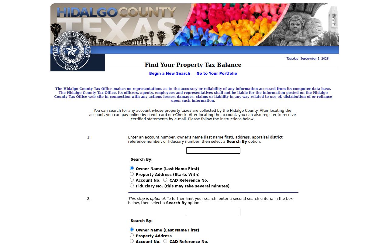
The captured controls support an address-based check. They do not prove that a ZIP-only query produces an Edinburg resident list.
When a parcel result and a mailing result disagree, do not choose one simply because it looks more familiar. The account or CAD reference identifies the appraisal record. The recorded legal description identifies the land in the Clerk's files. A county tax mailing address may identify where correspondence is sent, even when the physical parcel has a different postal label. That sequence keeps the postal clue in its proper place.
Edinburg Postal Map Context
The Hidalgo CAD appraisal-map item is a useful parcel-map entry point after an address is known. Its located metadata describes a Hidalgo County Map feature service, but the live interface did not expose a verified ZIP layer, adjacent-parcel button, or current layer list in the research. Do not assume that an on-screen boundary is a USPS delivery boundary without checking the source.
The Hidalgo CAD appraisal-map item identifies the available map resource.
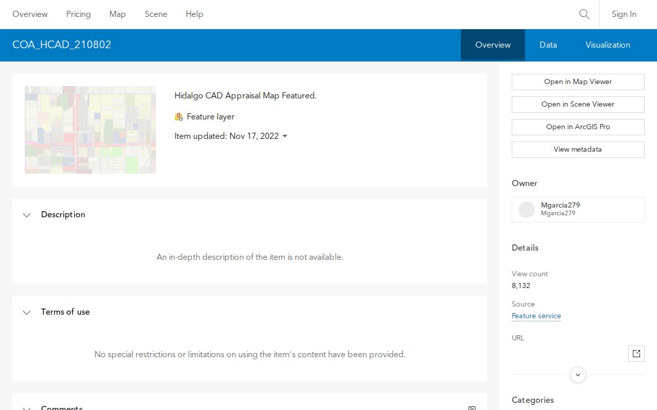
Use the map to relate a confirmed address to a parcel, then keep postal verification and parcel research as separate checks.
Edinburg Planning & Zoning maintains a separate online development-map link for zoning and platting context. Its research capture did not expose a postal layer or a complete set of live controls. City planning, the appraisal map, the County Clerk, and USPS each answer a different geographic question. None can substitute for all of the others.
Finding Records Near an Edinburg ZIP Code
A careful ZIP search starts with a complete address and ends with the correct custodian. The workflow avoids treating a postal zone as a people list.
- Confirm the complete mailing address through USPS and note whether the result is delivery or P.O. Box service.
- Use the street number and street name in HCAD or the Hidalgo tax portal to find the relevant parcel.
- Compare the parcel's situs, mailing address, account or geo ID, and legal description with the postal result.
- Use the Clerk's official-records search by party name, lot, block, or legal description when an ownership trail is needed.
- For association context only, use the Texas HOA management-certificate search, which has city, county, and ZIP filters and returns association records rather than household rosters.
Once a ZIP narrows the area to a known address, the Edinburg street directory has the fuller street-level records path.
Election materials do not fill that gap. The Hidalgo Elections public-information form includes the requester's address, city, state, and ZIP and offers map-size choices, but it is not a postal-area voter search. Texas Election Code rules govern a separate full-file request. Use an individual verification or an authorized records request for the narrow fact needed, rather than assuming postal geography identifies a group of residents.
Edinburg Postal Boundaries
USPS postal geography and Edinburg's city limits are different systems. The same postal city can include unincorporated Hidalgo County territory, and a city address can use a postal label that does not match a municipal line. Research did not verify a local example of either pattern for the four ZIPs. That gap should remain visible rather than being filled with an assumed boundary claim.
County address history adds another boundary issue. City Planning handles municipal zoning and platting, Hidalgo County Planning handles Chapter 232 development permits, HCAD maintains parcel identity, and the Clerk records legal instruments. A postal label cannot decide which jurisdiction holds a permit or a record. Compare the physical address and legal description before sending a request.
Postal limit. A five-digit routing label can confirm mail routing for a complete address, not current occupancy, voting status, or the people connected with a parcel. Verify each record with its custodian.
Edinburg Address Names Before 1911
Older address research has an extra local wrinkle. Hidalgo County's history says the settlement selected as county seat in 1908 was called Chapin and was renamed Edinburg by 1911. A pre-1911 deed, minute, or newspaper entry may use Chapin, Edinburg, or Hidalgo. Search the county, legal description, and historic place-name variants instead of assuming a modern postal code can reach that record.
That history is another reason the ZIP code directory should be used as current postal context, not as a shortcut around deed, map, or archive research.
Use the legal-description bridge when a street label changes. Hidalgo official-records Advanced Search separates recorded date from instrument date and offers grantor, grantee, party name, document number, lot, block, and legal-description fields. A plat or deed can connect a historic lot and block to a later parcel even where the modern street format does not appear in the older record. The HCAD account, CAD reference, or geo ID is useful for the current parcel, but it is not a substitute for that historical title description.
The record trail also reflects local growth. The city development history places irrigation in 1915, followed by agricultural development and trade. It does not identify a postal realignment. No official source in the research established a ZIP split, a ZIP-specific population count, or a delivery-boundary revision for Edinburg. A current ZIP code should therefore be paired with the date on the source, the parcel identity, and the relevant city or county custodian before it is used in a historical search.